About the MAPS Catalog
The Minnesota Automated Plate Scanner
The Minnesota Automated Plate Scanner Catalog of the Palomar Observatory Sky Survey (POSS I), hereafter the "MAPS Catalog," is derived from the this project's digitized scans of glass copies of the blue-sensitive (Kodak 103a-O) and red-sensitive (Kodak 103a-E) photographic plates of the original Palomar Observatory Sky Survey for the 632 fields with Galactic latitudes |b| > 20°. The scans are done in threshold densitometry mode, recording all pixels above the scanning threshold. The operation of the Automated Plate Scanner and the scanning procedures are described in detail in Pennington et al. (1993). The MAPS Catalog contains coordinates, magnitudes, colors, and many other computed image parameters for all of the matched images on the blue (O) and red (E) plates for nearly 90 million stars and galaxies down to fainter than 21st magnitude (in the blue). The stellar and non-stellar images are separated using a neural network image classifier, described in Odewahn et al. (1992, 1993), that has been trained to the plate limit.
Sky Coverage
The MAPS Catalog essentially covers the entire sky north of -33° Declination and more than 20° from the Galactic plane. This is approximately twice the sky coverage of the Sloan Digital Sky Survey. The plots below show the sky coverage of the MAPS Catalog:

Figure 4a: Sky Coverage of the MAPS Catalog (in B1950 Coordinates)
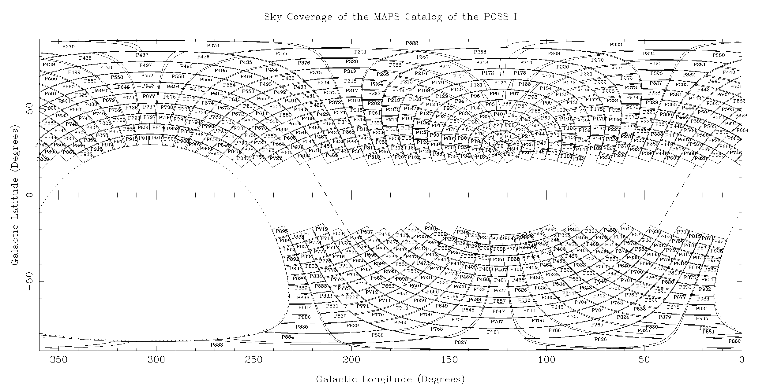
Figure 4b: Sky Coverage of the MAPS Catalog (in Galactic Coordinates)